Ethan Yackulic is currently a data scientist for the USGS in Flagstaff, AZ. He recently completed his master’s degree at Northern Arizona University with Dr. Nicholas McKay in environmental science.
Introduction
The wind howled and the clouds grew darker as the lake whipped the shoreline with increasingly violent whitecaps. I could sense the anxiety of the rest of my field team, perched precariously on a makeshift coring platform in the middle of an alpine lake. It was only October, but winter was announcing an early and unprompted arrival and we were miles away from our work vehicle and further still from the closest signs of civilization. Our margin of error had seemingly shrunk that morning; we enjoyed warm, gentle weather during our first few days at Crater Lake (no, not the famous one in Oregon), but on our last day, conditions were deteriorating from the get go.
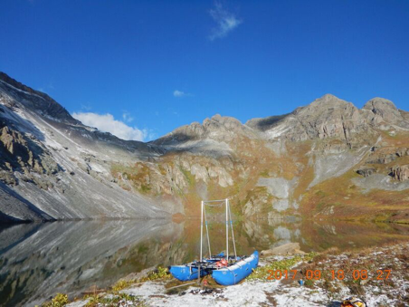
The coring platform fits up to the 3 people on board at all times and is equipped with 0 additional vessels in case of emergency.
While most of the crew focused on removing one final sediment core from the deepest basin of the lake, Charles Mogen had drawn the proverbial short straw and found himself paddling a constantly-deflating packraft across the lake with a car battery between his leg. A dangerous job in calm weather had become a death paddle as Charles valiantly tried to fill in the remaining transects necessary to illustrate the underwater topography of the lake bottom.
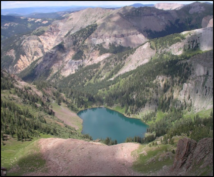
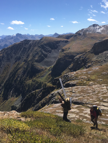
Crater Lake from up high on a calmer day. Note the moraine feature in the foreground, an artifact of the past glacial period.
For a moment, I was transfixed by the goal of our work; understanding the changes occurring in and around the lake through time and during periods of climatic change. Since the last ice age (~12,000 years ago), the landscape had shifted numerous times, from a glaciated cirque basin, to periods of more/less water than today. These shifts were also pronounced in changes in vegetation, as treeline fluctuated above and below the elevation of the lake and ecological niches opened and closed.
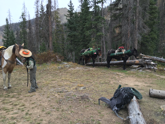
I jolted back to the present. A bolt of lightning cut through the sky above the lake basin and produced an earth-shattering thunder, signaling what we already knew: we had overstayed our visit to Mother Nature’s mountain oasis, and it was time for us to leave. A team of pack animals arrived and we quickly shuttled our gear onto the mules and horses and made haste toward the parking lot before dark. By the following evening, there was more than a foot of snow resting on the calm shorelines of Crater Lake.
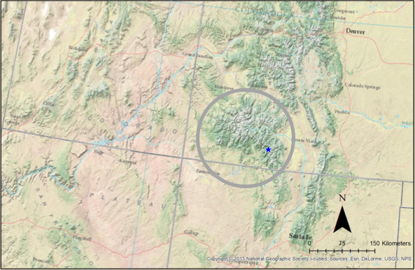
Location map of the Four Corners region showing the San Juan Mountains (circled) and Crater Lake (star).
Purpose
To the people, plants, and animals living in the Southwest, water is life. The San Juan Mountains in southern Colorado are the headwaters to the Rio Grande and Colorado rivers, massive watersheds that support vast communities and ecosystems. Understanding how past climates shaped the paleoenvironments (paleo-“past”) of the Southwest is essential to forecasting how modern, human-induced climatic changes might affect water availability for downstream recipients. This research not only informs our understanding of how regional temperatures changed since the last ice age, but also how temperature variability affects the distribution and storage of precipitation.
Supporting Details
To understand how temperature and precipitation trends have changed over the past 10,000+ years, I looked at sediment cores that were taken from alpine lakes (i.e. high elevation lakes—around 10,000 feet above sea level) in southern Colorado. Alpine environments are sensitive to slight changes in climatic conditions, and lakes can provide natural records of these changes through the preservation of organic and inorganic material in mud and sediment. It’s like a dirt time capsule: the presence of different organisms, woody fragments, and even pollen and proteins can provide valuable information about environmental and climatic conditions.
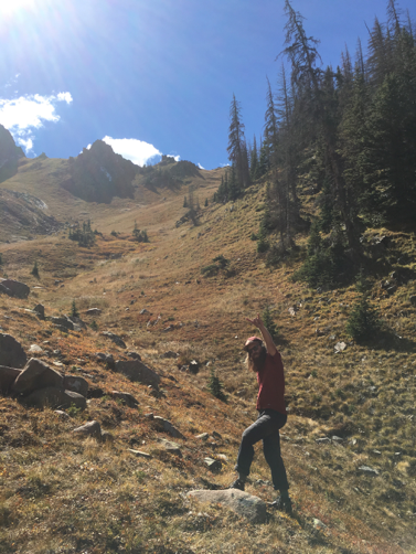
The best part of my work was undoubtedly spending time in the field, where I was given the difficult task of hiking across the beautiful peaks and valleys of the Rocky Mountains in search of ancient mud. Remote locations are preferred, because they are less likely to have been tampered by various forms of human disturbances over the past couple 200+ years. This led Charles and me to core some of the prettiest and least accessible lakes I have ever seen, often climbing over rocky passes where no established trails existed.
When I wasn’t in the field, I was working with a hyperspectral camera. Put very (very) simply, this hyperspectral camera is sort of like a photo scanner. These long tubes of lake-mud were split open and scanned under the machine. What makes the camera so unique is its ability to detect the individual wavelengths that make up the colors we see with our eyes. So, when I scanned my sediment cores, I was looking at wavelengths that could be related to the concentrations of different photopigments, such as chlorophyll. If that sounds complicated, that’s because it is—so much so that I HAD to take a trip to Switzerland to be trained on how to use the machine. I won’t dwell on how I used the machine, but suffice to say, the beers, chocolates and exotic meats alone made my “business” trip worth it.
Wrap-up
The results from my work showed that spectrally-inferred concentrations of phyocyanin (a photopigment found only in cyanobacteria (“blue-green algae”)) in the sediment cores from Crater Lake aligned with global temperature reconstructions over the past 12,000 years. In other words, the concentration of cyanobacteria was responding to changes in temperature: warmer periods caused a proportional increase in the amount of cyanobacteria while colder periods caused a proportional decrease. My study showed that Crater Lake warmed rapidly after the end of the last ice age until around 7-8,000 years ago, when the environment was likely drier and warmer than today. Temperatures remained high until around 5,000 years ago, and there is significant evidence that the water level at Crater Lake during this time period was much lower than at present. This is likely due to a decrease in snowpack, as winter precipitation is thought to have decreased during this period and summer temperatures were regularly warmer. I believe that this is strong evidence of the potential peril of future 21st century warming; as perennial snowpack decreases, water bodies will likely start to shrink as evaporation rates increase. More work is necessary to confirm the past relationship between temperature and moisture, but this study is evidence enough that something as simple as mud can provide valuable information that can help develop practical policy decisions about water management.
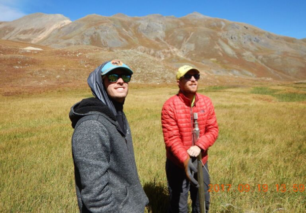
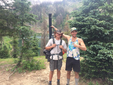
My research would not have been possible without the support, guidance, and friendship of my advisor, Dr. Nicholas McKay (right).
![]() This work is licensed under a Creative Commons Attribution-NonCommercial-ShareAlike 4.0 International License.
This work is licensed under a Creative Commons Attribution-NonCommercial-ShareAlike 4.0 International License.

