Karsten is a regular contributor to TravelingGeologist. See his contributions here.
Some places have a special place in the hearts of geologists. Iceland with its volcanoes. The Dorset coast because it is the cradle of modern geology. The Oslo Graben because of its complex geology.
Some places are famous because they gave name to geological time periods. Devon in England gave name to the Devonian, because English geologists described rocks of that age from there. The Jurassic is from the Jura Mountains in France and Switzerland (Une Vengeance for the Devonian?). The Permian got its name far away, from ancient kingdom of Permia, at the foothills of the Ural mountains in Russia, where the city of Perm now resides.
This summer, I had the opportunity to make a pilgrimage to this special place, at a joint oil company excursion, led by Russian oil company Lukoil. A two hour flight eastwards from Moscow is literally as long as a flight along the length of Norway from South to North and the farthest East I have been – but compared to the vast endlessness of Siberia it is nothing.
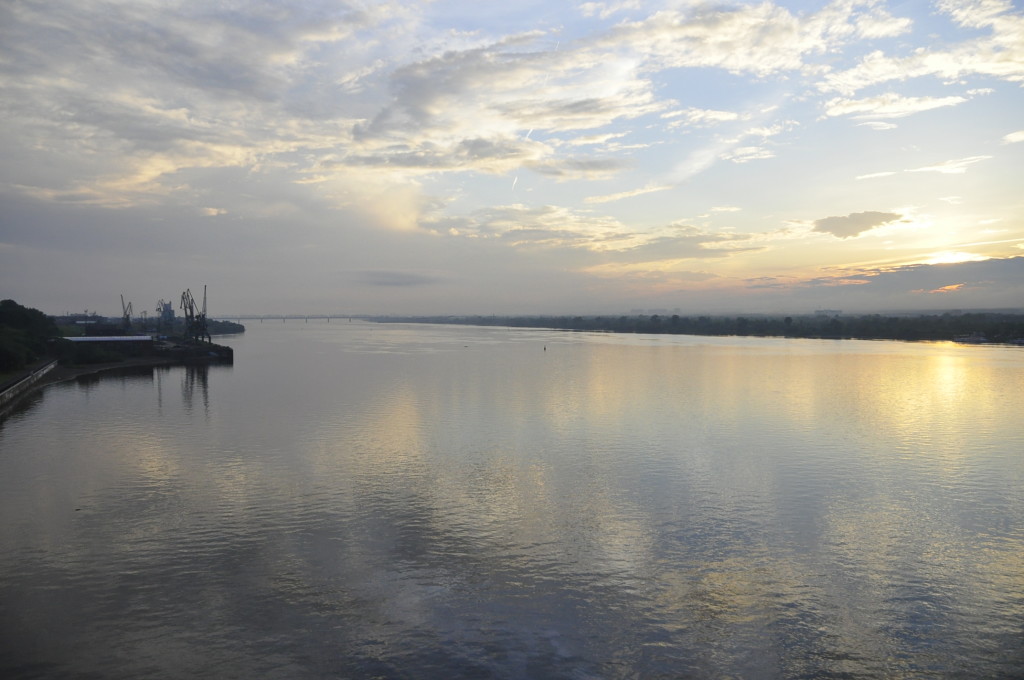
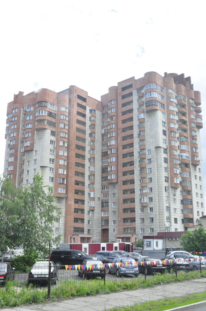
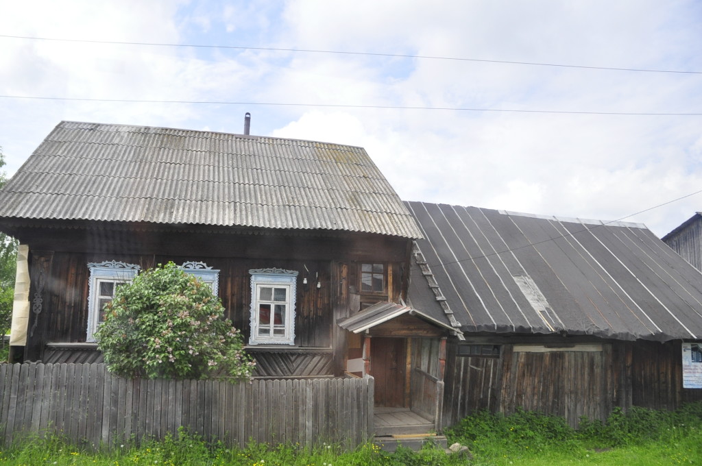
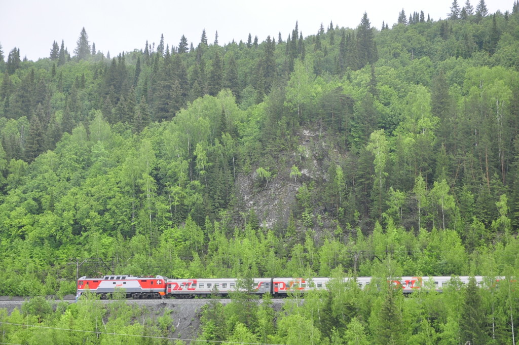
Perm city is a hub at the intersection between the mighty river Kama (which southwards becomes Volga), and the Transsiberian Railroad, and – largely because of the Permian rocks – an important centre for oil production, refineries and related industry. It is quite wealthy by Russian standards and has a fascinating mix of buildings from the Czardom, Soviet time and after. In geo-speak, Perm’s real estate stratigraphy consists of pre-Soviet timber houses and elegant (but worn) apartment buildings, syn-Soviet concrete blocks with a characteristic pattern of oversized bricks without any cover, and post-Soviet modern office buildings and apartment blocks, some in a style I call “back to the 80’s retro-psychedelic”. New motorways lie side by side with bumpy roads and old tramlines.
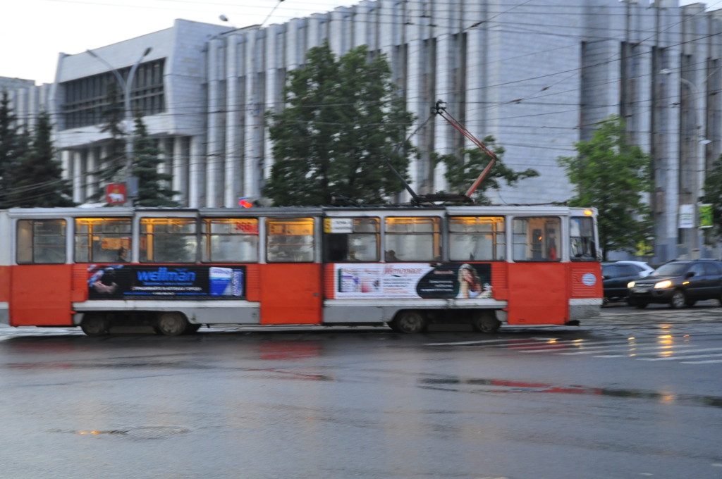
Old trams and seventies-style concrete buildings: The heritage from Soviet time is still evident in Perm.
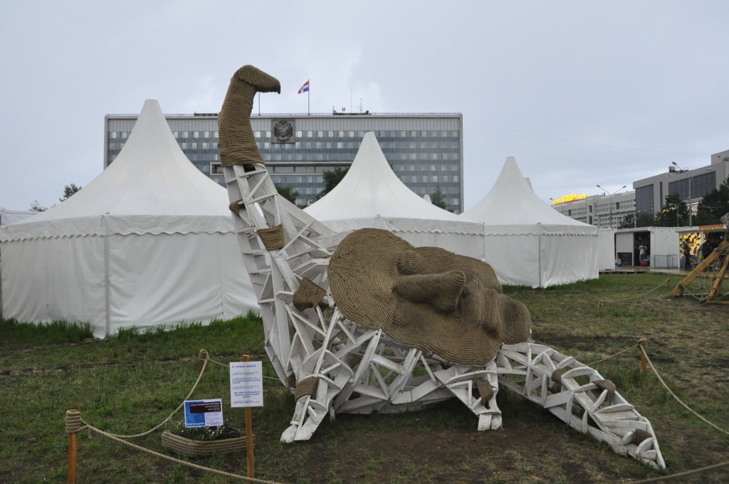
Nessie’s Russian sister? Each June, the White Nights arts festival gathers the Permians for exhibitions and concerts in the city centre.
The Permian period was actually bapthised by an English geologist, whose full alphabet soup title was Sir Roderick Impey Murchison, 1st Baronet KCB DCL FRS FRSE FLS PRGS PBA MRIA, born 22th of February 1792. Murchison was the son of a wealthy family, so after school and the mandatory English ‘Gentleman’s Years In The Army’, he married and spent his time hunting foxes. His wife, Charlotte, got interested in geology and, together with the chemist Sir Humphry Davy, convinced her husband to take up the subject.
Murchison gained scientific fame for describing the Silurian system in England and Wales, he participated in understanding the Devonian, and travelled through France and the mini-states-that-would-become-Germany to study the geology there. Charlotte accompanied him on many trips, and was a skilled geologist in her own right.
In 1841, he embarked on a trip through Russia, together with a party of three; French palaeontologist Edouard de Verneuil, Estonian-Russian mining expert Alexander von Keyserling and the Russian officer and mineralogist, Nikolai Koksharov. From Moscow, they travelled the road to Nizhni Novgorod, and further through the endless woodlands to the Perm area. At this time, geologists had recognised that there was a something in between the time periods they had called Carboniferous and Triassic, but not understood it properly. The trip to Russia, with and the widepread outcrops of Permian rocks finally nailed it. In 1845, Murchison published a large monograph on the Russian Permian geology, laying the final big puzzle bricks in Paleozoic stratigraphy.
From here, I will take you onto a journey through Murchison-land. Not the same places, because I do not know exactly where he went (need to read that Big Book? 🙂 ), and geology has proceeded since then. Rather, it will be a trip back in time, to some distinct localities, which illustrate various geological subjects.
Let’s start with carbonates – a new land for a geologist who previously worked only on clastic rocks.
Clastic rocks refer to rocks composed of mud, sand and other materials composed of detrital grains that float with a stream, river or current and then laid down. After that, they are buried and the overburden can squeeze them so that the porosity reduces or disappears. Since oil is stored in these pores, it is important for geologists to try to predict how much of the rock down there is porous. In addition to the squeeze, heat can make grains dissolve at contacts and fall out again as cement, or clay minerals – mud crystals – can fall out from circulating pore water. The porosity development is never entirely predictable – kind of good, because we geologists need to still have jobs 🙂 – but in general follow some depth and temperature trends, than at least make them fairly predictable; unpredictable in a predictable way.
Carbonates are a different game. Carbonates are like ghosts, elusive, unpredictable, because of the way they form. Carbonates are made by life itself. Shells, corals, algae – carbonate rocks are shells or skeletons of these organisms. Which organisms that form rock vary through time, because of evolution, so geologists must try to understand rocks formed entirely by organisms that do not more exist. One extreme end of carbonate types are the chalk reservoirs of the North Sea, which are built of the plankton called coccoliths, which have shapes like tiny UFOs, and stack like a card house when they sink to the seabed. Another extreme example are coral reefs, which grow from the seabed and spread out where topography and water quality allows.
Geologists distinguish between primary and secondary porosity. Primary porosity is the one that is in the rock when it forms. In clastic rocks, it is the space between the newly laid grains. In carbonates, it can be holes in corals and between them in reefs, space between mussel shells, between tiny-tiny algae shell… But burial usually very soon crushes porosity, and cement fill the pore spaces. What gets preserved is very unpredictable. In some cases, like the North Sea chalks, some porosity remains simply because oil came into the pores before cementing really got along, and stopped it. Luck is still necessary to find oil!
Secondary porosity is porosity that develops by making new holes and pores in the rock, long after burial. There are at least three ways to do it in carbonate rocks: The first is karst, to dissolve the carbonate in circulating water, because the water is slightly acidic. It is the slow motion version of what happens if you drop a piece of chalk in acid or vinegar. Karst can create huge halls with dripstones – or small holes for oil reservoirs. The second way is dolomitization, a more elusive process where calcite goes over to the mineral dolomite. The two minerals have the same crystal structure, but in dolomite, half of the calcium is replaced with magnesium, and that structure takes less space. Thus, if the pore water has lots of Mg2+ ions in it, the minerals can change and create new porosity. The third way to create porosity is the simplest; create lots of tiny fractures. More on fractures and karst follows.
But now, back to the geology. Lets look at some real rocks: The Yermak reef, close to Kungur, offers a cross-cut through a coral reef, and it highlights how heterogeneous reefs are as reservoirs.
The reef has its name from Yermak Alenin, a hero in Russian folk history. Yermak was a Russian Cossack, who – according to history – led the Russian conquest of Siberia, and in 1582 won the final battle against the rule of the Islamic Khan. The actual historical evidence for Yermak as a person is thin, to some extent a folk tale where he is a larger-than-life figure. But as the story goes, Yermak travelled past Kungur on his campaign, and got the prominent cliff named after himself.
At distance, it is just a grey cliff. Muggles might spend a second thought on why it stands out, but not a third. Geologists are different, if something stands out, it is hard and hard often means special. A dike, a pegmatite, a hard layer – or a coral reef. One needs to go to the foot of the reef to understand its true nature.
Holes everywhere, most small, some larger. The coral reef wall looks like a big sponge where the production process went wrong, and inflation stopped halfway. Some of these probably are holes after shells that have eroded out, some are karst holes. The rock itself is massive, grey, and built of a mix of many tiny, fingered corals and other reef building organisms, shell and clam fragments, grains and mud from eroded from the reef. Here and there, networks of rib corals stand out, harder than the host rock.
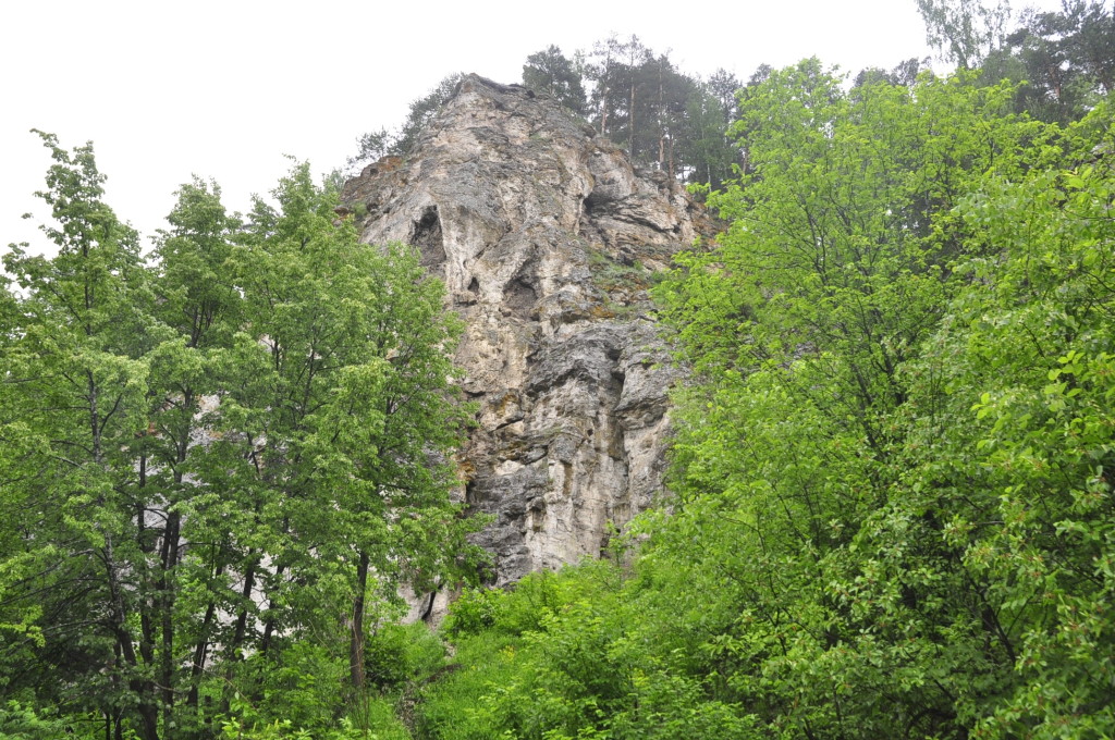
The Yermak reef rising above the forest in the Sylva river valley. Note the large holes halfway up; holes etched out by karst.
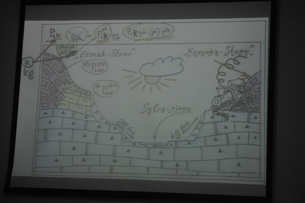
Geological section with the Yermak coral reef, the Sylva river, the Transsiberian railway and another reef, Koronka, to the right.
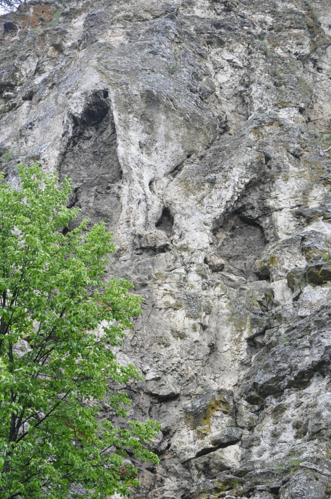
Yermak reef in close-up: A hodgepodge of corals, bryozoans, shells and debris, with some large and many small karst holes.
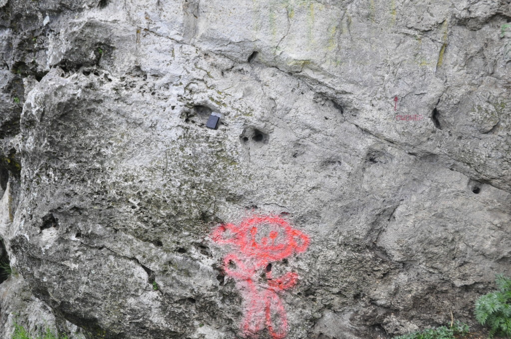
Even closer-up view of the Yermak reef rock: The rock is quite massive outside holes that have formed by percolating groundwater. The holes are concentrated in zones with many shell or coral fragments. Compass and Teletubby-Alien for scale.

Etched-out corals form porous zones in an otherwise quite tight rock. The Yermak reef would probably make a poor oil reservoir.
There is no oil in the Yermak reef, but if there had been, it would assemble in those holes. If it could get in there… Oil comes from a source rock, a rock rich in organic material, usually algae, that is buried, heated and converts the organic matter to oil. The oil then floats into the reservoir so we can drill and produce it. But a very common problem with carbonates is that they are like a cheese with holes: Lots of holes with volume to fill – good porosity – but since the holes are not connected, oil cannot go into them – no permeability – so they are filled with the water that remains from the formation. In many cases, oil floats because of later developed fractures, when Mother Nature and Father Tectonics do some natural “fracking”, by stretching, folding or squeezing the rock.
And there have been lots of squeezing and folding near Perm, from the Uralian orogeny that tied Siberia to the European plate and created the big continent in the late Paleozoic. Although Yermak himself seems to have fought off the crunch, the push in front of the Ural mountain chain has, on a larger scale, folded and thrusted the rocks into structures that often constitute oil fields. On smaller scale, it has also “fracked” them, so oil can flow in and out, into the wells in “Lukoil land”.
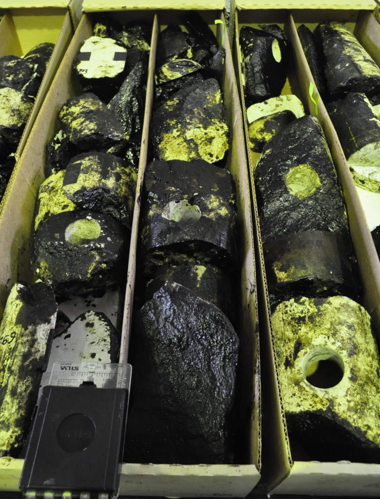
If oil comes in, how does oil in a reservoir look like? Muggles often think of reservoirs as holes in the ground, filled with oil seas, but, as you have seen, they are more like rigid sponges. In petroleum wells, it is common to carve out pieces of the reservoir rock as the well goes through it – “taking cores” in oil-speak – and these will be brown or black from the oil.
Lukoil has a core analysis shop in Kungur, a city south of Perm, where they conduct analyses of cores from their oil wells all over Russia. On the tables were served freshly lifted and cut cores, stained with brown or black oil. Note how the oil is patchly distributed in the rocks, even after millions of years in the ground – some parts of the rock just is too tight.
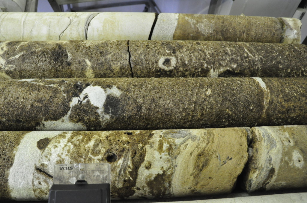
Cores at the core store in Kungur. Soaked in brown oil, they make the store smell like a car repair shop. The white zones are rocks that have so low porosity that the oil has not managed to penetrate into them. Who said oil production was meant to be easy?
In the core shop, the they are put through all kinds of purgatory: high-pressure piston chambers to test porosity, boiled in oil and soaked in mercury (!) to test permeability – how easy oil flows through the rock. Such analysis is very important, because it can tell the difference between finding oil, and finding oil that can be produced for profit.
This was first posted at karsteneig.no.
![]() This work is licensed under a Creative Commons Attribution-NonCommercial-ShareAlike 4.0 International License.
This work is licensed under a Creative Commons Attribution-NonCommercial-ShareAlike 4.0 International License.

