Chris has recently taken a position as a research fellow at Curtin University in Perth, Australia. You can see more of his current research here.
The San Andreas Fault is likely the most well-known fault in North America. Its notoriety likely comes from the massive 1906 San Francisco earthquake that devastated the city. Following a 7.8 magnitude earthquake, fire broke out and destroyed nearly 80% of the city. This disaster is still considered one of the worst natural disasters of United States history.
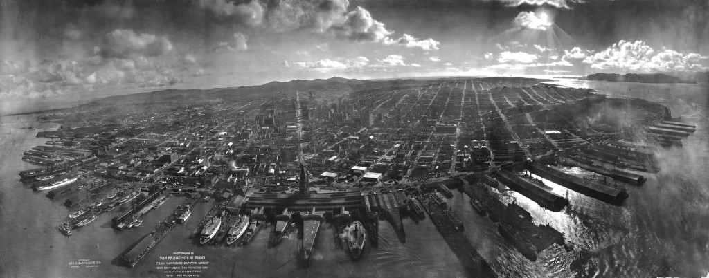
A photograph of San Francisco six weeks after the 1906 earthquake and fire taken from a camera suspended on a kite. The water in the foreground is San Francisco Bay, with the Golden Gate to the right, rear. Note the absence of the Golden Gate Bridge and the San Francisco-Oakland Bay Bridge, which had yet to be constructed. Photograph by George Lawerence from the US Library of Congress. Click on the image to see the spectacular high-res version.
The San Andreas fault is a continental transform fault that stretches from the northern tip of the Gulf of Mexico to Mendocino. This fault was instrumental in our understanding of earthquake recurrence. Major seismic events along the Parkfield section of the San Andreas were recorded in 1857, 1881, 1901, 1922, 1934, and 1966. The apparent recurrence interval of earthquakes led scientists to predict that another earthquake should occur in Parkfield in 1993. Although the event occurred in eleven years later the San Andreas Fault has become one of the most important areas in the world for large earthquake research.
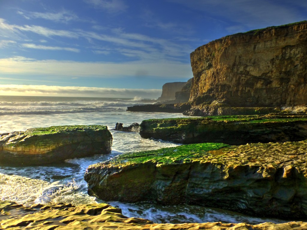
My recent encounter with the San Andreas was an indirect one. I didn’t see any of the classic localities at Wallace Creek or the Parkfield bridge, but the evidence of the fault was unmistakeable at Bonny Doon Bay near Santa Cruz. The rocks surrounding the bay are the Santa Margarita Formation and are composed of sandy limestones and marls. These shallow marine deposits were deposited off Miocene and have subsequently be uplifts to 10’s of meters above sea level. The terrace on top of these Miocene rocks represents a 100 thousand year old shore line that has since been uplifted due to transpression along the San Andreas fault. By calculating the age of the terrace and the sea level at the time of deposition we arrive at an uplift rate of 0.4 mm/yr. Although that seems small after 10 million years the terrace has been raised nearly 40 meters (see Weber and Allwardt, 2001)!
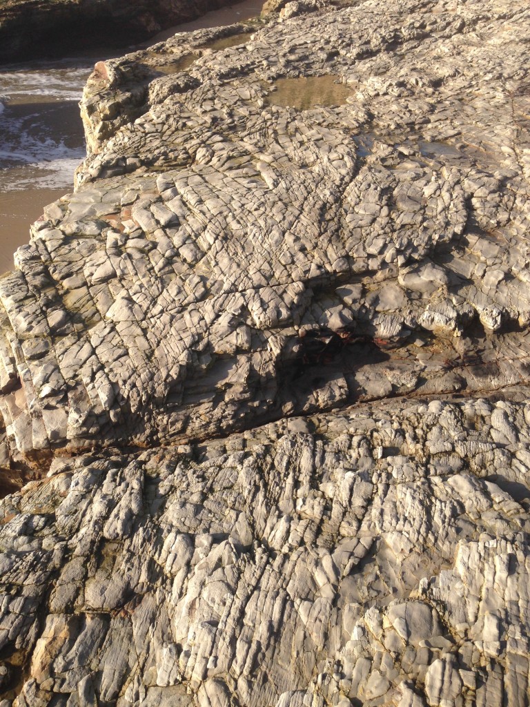
On the bedding planes of the finest-grained units are tightly-spaced cleavage. This cleavage is formed as the marls are put under pressure and begin to dissolve forming planar foliations. The cleavage planes in these marls are found perpendicular to bedding.
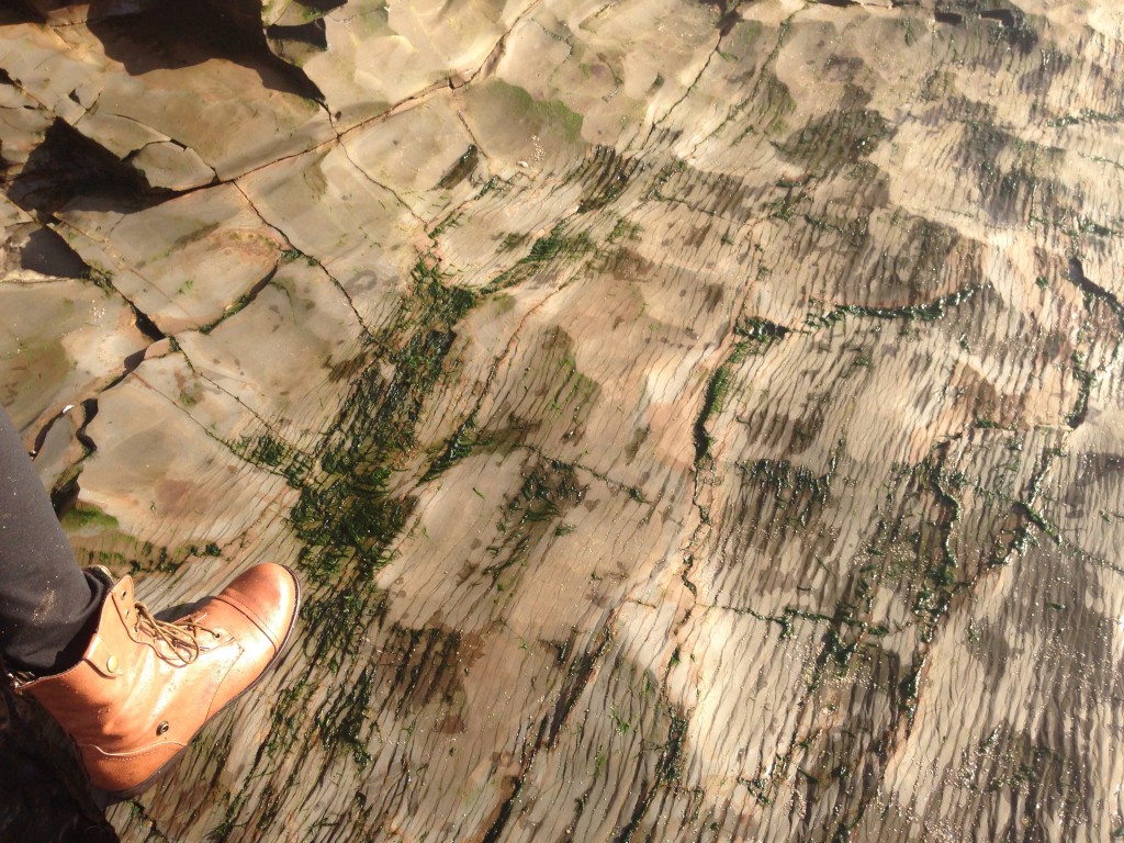
Tightly-spaced cleavage in marl viewed along horizontal bedding plane. Although providing a boot for scale, the wife was less than impressed with the wedding anniversary geology.
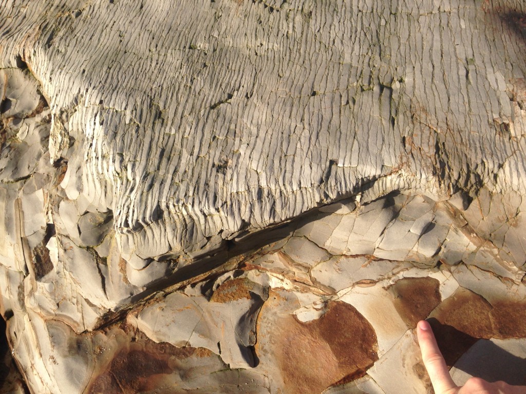
This shows the preferential way in which the cleavage forms in differing rock types. The lower bed is far more calcareous where as the upper bed (lower part of the image) is contains more silica and thus less able to form pressure solution cleavage.
In the more competent layers of coarser grained sandy limestone units show faint signs of pressure-solution cleavage but clearly show conjugate fractures. The cleavage planes in the marls and the faint cleavage in the coarser grained beds are in the same orientation and parallel larger fractures. An additional set of fractures are separated by 60º from the other fractures and cleavage planes. Fracture planes with this 60º separation are referred to as conjugate fractures.
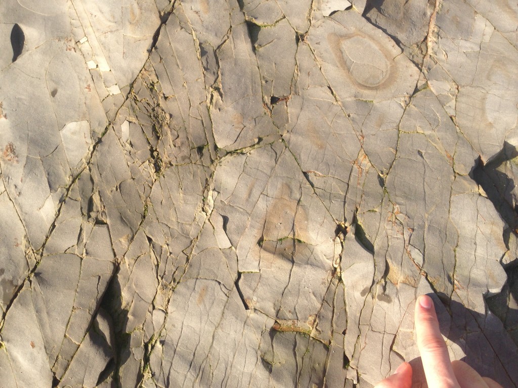
Beautiful conjugate fractures in sandy limestones with cleavage forming preferentially along one fracture orientation.
Conjugate fractures are an amazing tool when determining the stresses that created these fractures. In 1905, Scottish geologist Ernest Anderson used a series of cylindrical shale cores and a triaxial press and recognized the fracture patterns seen in the shale cores were correlated to the principal stress directions. In our three dimensional world, three planes of stress can be placed on a rock, each 90º degrees from each other along two axes. These are referred to as σ1, σ2, and σ3 (σ = sigma), each of which correspond to the maximum, intermediate, and minimum stresses, respectively. When σ1 was vertical and σ2 and σ3 were equal the fracture pattern that resulted was a perfect conjugate fracture pattern with two fractures separated by 30º from the direction of maximum stress (σ1).
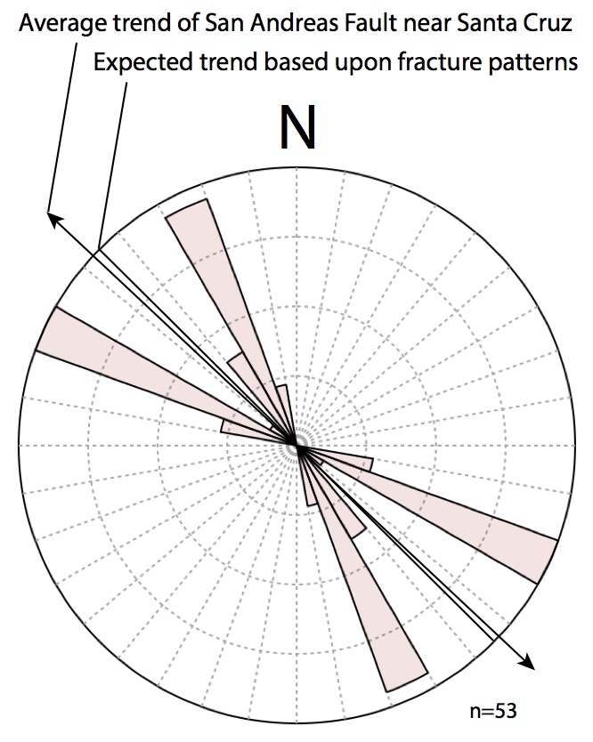
If we apply this same principle to the rocks of Bonny Doon, we can infer that the maximum stress during which these rocks were strained and fractured was the bisectrix of the conjugate fracture’s acute angle. Although I was on holiday at the time with my lovely wife, such a spectacular example of conjugate fractures could not go unmeasured. So I pulled out my iPhone and using the Lambert app, I measured the orientation several dozen conjugate fractures. The rose diagram below shows average trends of the fractures at ~335º (NNW) and ~295º (WNW). The bisectrix of these fractures is around 315º. It is therefore postulated that the maximum stress that strained these rocks had a vector of NW/SE. Interestingly (and unsurprisingly), this is the exact vector of the San Andreas Fault near Santa Cruz. So my hypothesis is these fractures were created during transcurrent movement along the San Andreas Fault.
There is one other puzzle that I do not have answer for is why the cleavage planes are exclusively found along one orientation. Perhaps this is because σ2 and σ3 were not equal. Perhaps this is evidence of a local stress field whereas the conjugates show the far-field stress. The transpressional uplift likely supports this, but the specific geometries of this cleavage formation escape me. My hour long foray at Bonny Doon was definitely not enough to detail the intricacies of the San Andreas. I hope to return soon to further my investigation.
![]() This work is licensed under a Creative Commons Attribution-NonCommercial-ShareAlike 4.0 International License.
This work is licensed under a Creative Commons Attribution-NonCommercial-ShareAlike 4.0 International License.

