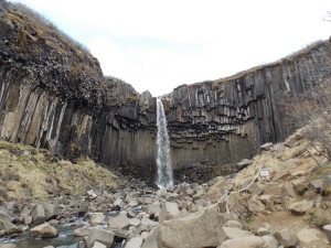
Iceland was recently described to me as “Disneyland for Geologists”. The meaning of that phrase is obvious. Iceland is littered with the volcanoes, glaciers, and active faults that make geologists’ blood start pumping. But there are many places in the world that have all of these different features. What separates Iceland apart is the overwhelming sense of ‘raw-ness’ that exists there. The active tectonic and geomorphic agents and their effects are ubiquitous with little vegetation to hide behind. This gives you the sense that you are catching the earth in its raw form, still being made, before it received all the adornments of deep time.
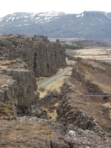
Perhaps the most famous historical site in Iceland is also one of its most striking tectonic features. This rift is actually the boundary between the North American and Eurasian plates. The mid-Atlantic rift comes onshore in Iceland, with the whole plate boundary buoyed up by the deep mantle hotspot that also lies beneath the island. This is also the site where the ancient Icelandic parliament, called the Althing, first met in 930 AD and has met almost continually since then, making it the longest serving parliament in the world.
 |
|
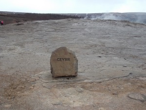
The original Geysir is located in Iceland, although it only erupts now when prompted by ambitious Icelanders.
|
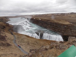 |
| The great Gulfoss waterwall is an awe-inspiring site. The south coast of Iceland is littered with huge waterfalls as water sourced in the recently uplifted highlands plunges into the sea. |
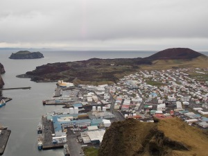
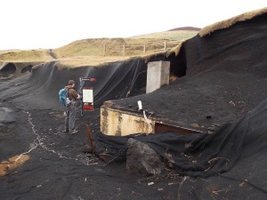
Heimaiy, located on the Vestmann islands is the site of a volcanic eruption in 1973 that almost completely destroyed the small town and harbor on this tiny island. In the story so eloquently told in the Pultizer Prize winning author John McPhee’s work “The Control of Nature”, the fierce Icelanders brought in huge pumps in order to cool the threatening lava flows with sea water. Their efforts very well may have saved the harbor and its important economic benefits. But while the harbor was saved, much of the town was still covered by lava. Many streets now dead end into a 30 m tall fresh basalt outcrop.
 |
|
A closer look at some of the homes buried in ash at a site Heimaiy calls “The Pompeii of the North.”
|
The Skaftafellsjokull glacier is an outlet glacier bringing ice down from the large Vatnajokull ice cap. I was told that these glaciers in Iceland are not remnants of the last glacial maximum but formed during an usual cold spell approximately 2500 years ago.
 |
| The Skaftafellsjokull Glacier |
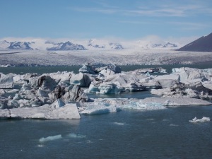
In the 1920’s this outlet glacier receded enough to form a brackish lagoon with a narrow outlet to the sea. The site is now called in Joksularon, and is the best place to see icebergs in all of Iceland. Unfortunately, coastal erosion will soon destroy the narrow passageway between the lagoon and the sea and possibly destroy this beautiful site.
![]() This work is licensed under a Creative Commons Attribution-NonCommercial-ShareAlike 4.0 International License.
This work is licensed under a Creative Commons Attribution-NonCommercial-ShareAlike 4.0 International License.

